0 £0.00
products in your basketto quote Checkout
Ooops no items were found.
Try something else.
Ok
Loading…

Simple Maps Pack 3

Category Maps & Compasses
HE1555759

Simple Maps Pack 3

Product Code: HE1555759
Category Maps & Compasses

Description

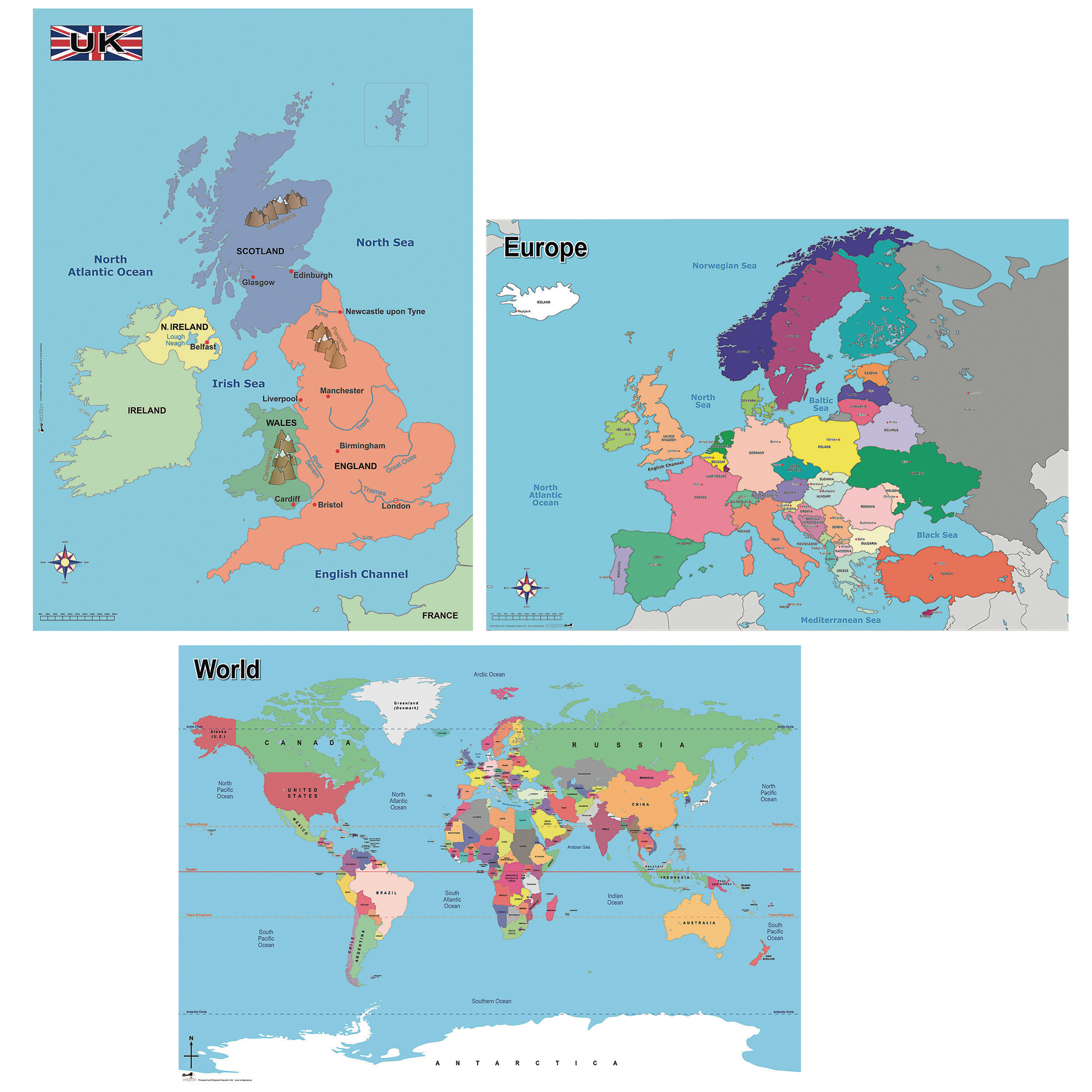
This set of simple, colour-coded maps helps pupils develop key geographical knowledge and skills, making it easy for teachers to deliver curriculum objectives in Geography. Designed for classroom use, these maps support learning about the UK, Europe, and the wider world for Key Stage 1 and 2.

Use to support study about contrasting localities and to learn about the location of the UK in relation to other countries in Europe and the rest of the world.

  • Includes 3 maps: UK (570mm x 670mm), Europe (A1, 594mm x 841mm), and World (A1, 594mm x 841mm)

  • Clearly marked with principal towns, cities, country borders, capital cities, seas, rivers, mountains, oceans, and key lines such as the Equator and Tropics

  • Colour-coded for easy identification and comparison of locations

  • Suitable for ages 5+

  • Ideal for wall display or tabletop group work

Specifications

UNSPSC Code

55101501.0

Weight

1kg

Height

9.99mm

Width

9.99mm

Length

9.99mm

Brand

Own Brand

Categories

Geography

Category

Maps & Compasses

From
£51.65 Pack of 1
/
- +
Compare

Simple Maps Pack 3

Category Maps & Compasses
HE1555759

Simple Maps Pack 3

Product Code: HE1555759
Category Maps & Compasses

Description

This set of simple, colour-coded maps helps pupils develop key geographical knowledge and skills, making it easy for teachers to deliver curriculum objectives in Geography. Designed for classroom use, these maps support learning about the UK, Europe, and the wider world for Key Stage 1 and 2.

Use to support study about contrasting localities and to learn about the location of the UK in relation to other countries in Europe and the rest of the world.

  • Includes 3 maps: UK (570mm x 670mm), Europe (A1, 594mm x 841mm), and World (A1, 594mm x 841mm)

  • Clearly marked with principal towns, cities, country borders, capital cities, seas, rivers, mountains, oceans, and key lines such as the Equator and Tropics

  • Colour-coded for easy identification and comparison of locations

  • Suitable for ages 5+

  • Ideal for wall display or tabletop group work

Specifications

UNSPSC Code

55101501.0

Weight

1kg

Height

9.99mm

Width

9.99mm

Length

9.99mm

Brand

Own Brand

Categories

Geography

Category

Maps & Compasses

From
£51.65 Pack of 1
/
- +
Compare
SEARCH ×